English
 Italian
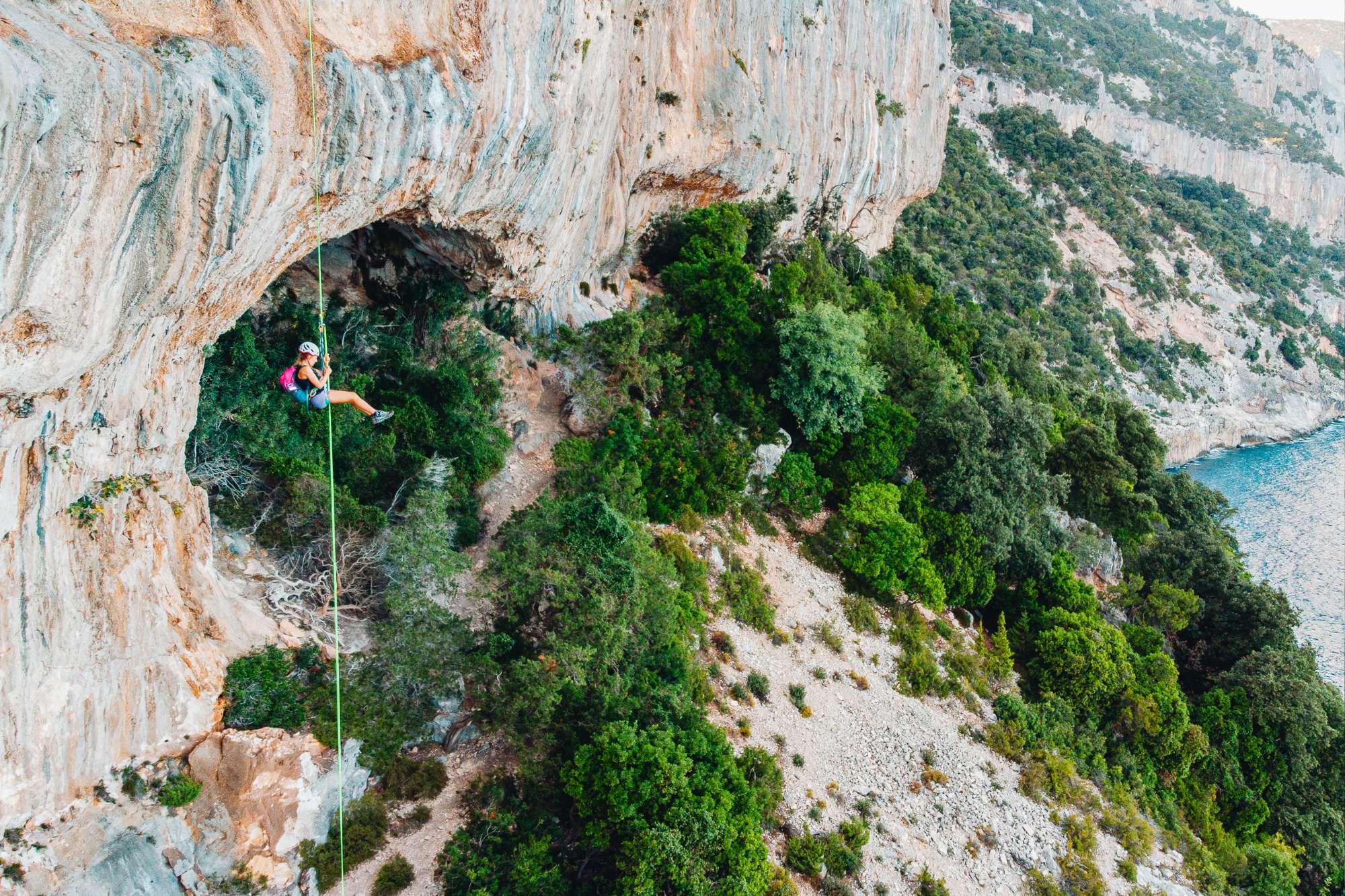
Day 1 Meeting in the morning at 9:00 AM at the small port of Santa Maria Navarrese, then departure for the trek. Following a comfortable trail, we will reach Pedra Longa in about 1 hour and 30 minutes, a spectacular bay dominated by the towering limestone pinnacle of the same name. From here, the path continues towards the sheer wall of Punta Giradili, which we will cross via a stunning ledge before reaching the Supramonte of Baunei and the abandoned Su Idileddu sheepfold, now converted into a partially equipped bivouac. Camp setup, dinner, and overnight stay.
Selvaggio Blu is a trekking experience for those who want to spend a week immersed in the untouched nature of Sardinia’s eastern coast. Far from modern comforts, nights are spent outdoors or in natural shelters such as caves and old shepherd huts known as pinnettos. Each day is spent walking through an extraordinary landscape of rugged cliffs, Mediterranean scrub, ancient trees, and breathtaking views overlooking the sea.
The route follows the original itinerary designed in the 1980s by Mario Verin and Peppino Cicalò, linking a network of shepherd and charcoal burner paths. In five days of hiking and sleeping à la belle étoile, the trail connects Santa Maria Navarrese to Cala Sisine, staying true to its authentic essence and offering a unique wilderness experience.
Thanks to careful logistical planning, hikers can travel light, carrying only the essentials: water, a few snacks for the journey, and a camera to capture the countless stunning moments that change at every turn of the trail, winding through vegetation, rocks, and the sea.
Travel program
NB The program may undergo changes in the price/timetables/location of overnight stays due to the unavailability of services (flights/overnight stays) to be verified when booking. On site, in less than optimal weather and safety conditions, the Alpine Guide will confirm the itineraries included in the program day by day.
Is it for me?
Adventure
Commitment
Landscapes
Travel factor
Gastronomy
Culture and folklore
LEGEND: based on our personal experience, the evaluations give a subjective, measured and highly reliable value of the elements that make up the travel experience.


Other informations
Duration
5 days / 4 nights
Guaranteed departure
Minimum 5 partecipants
Documents
Identity Card

The participation fee includes
- Guidance and full organization by an alpine guide
- Logistics support for luggage transport and food supplies
- Optional services upon request:
- Accommodation booking in an apartment with B&B service in Santa Maria Navarrese for the night before departure and the final evening of the trek
- Travel arrangements to reach Sardinia
Price per person
from € 1270
Deposit of € 318
Payment Methods and Cancellation PolicyDeparture
- 1 - 5 May 2026 Proceed with registration